Hotel terbaik di Baxoi
Masukkan tarikh perjalanan anda untuk menyemak harga dan ketersediaan terkini
Leret ke atas untuk melihat lagi
Tapis mengikut:
Penarafan bintang hotel
≤2345
Penapis Popular
Terbaik 4.5+Hebat 4.0+Bagus 3.5+Baik 3.0+20 hotel di Baxoi
Pilih tarikh perjalanan anda untuk melihat harga terkini.
Paling Popular
Harga Terendah
Paling hampir ke Pusat Bandar
Mendapat Ulasan Terbaik
Hotel berhampiran Baxoi
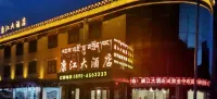
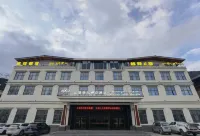
LLansehongse 2023.12.01
地點在318道邊,停車場巨大,非常方便
也有很多人直接就住在停車場車裡
酒店設施一般,服務一般
簡單一個人對付一晚沒問題
給了個三樓的房間,位置在樓梯間那邊,房號不記得了,就是出了電梯後找不到任何我房號的指引,整個樓層找了一遍才找到自己的房間,前台入住時候也沒人跟我説一聲這個房間很難找
89 ulasan
3.9/5
Harga bermula
€ 14
satu malam
Hotel berhampiran Baxoi
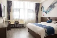
PPengguna Tetamu 2022.07.25
沒想到小縣城竟然有真好的酒店。不要看外表,裏面設施齊全,乾淨衞生。最最最重要的是,酒店餐廳美麗的陳佳麗小姐姐,人美心善,必須説一説。當天酒店住宿我們選擇了酒店餐廳,價格合適,味道不錯。比外面縣上的餐館乾淨衞生。飯後幾個小時過去了,我突然發現手包不見了,裏面是我全部身家,證件錢包銀行卡全在裏了,沒有證件我的自駕遊怎麼回啊。回想經過,應該是落在酒店餐廳了。當時晚上快10點了,我抱着試試心裏,看能找回來嗎。陳美麗小姐姐竟然給我保留着,還輕描淡寫地説不用找老闆表揚。當時太感動了太激動了。強烈推薦這家酒店。另外早餐也非常豐富可口。推薦大家都來這家酒店。
Sangat Baik
70 ulasan
4.5/5
Harga bermula
€ 22
satu malam
Hotel berhampiran Baxoi
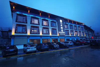
22002283830 2024.09.25
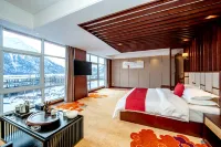
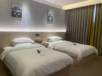
車子一進大院服務員就已經在樓梯相迎,服務非常周到。準備的薑茶非常好入口,第二天因為要上冰川也讓前台備好帶走。晚餐可以選擇的不多,下午茶雖然來晚了但也拼了一盤送到房間。枕頭太軟太矮,睡得非常不舒服,氧氣儀的位置不明白為什麼要放在床頭,整晚都是流水聲。
Cemerlang
146 ulasan
4.7/5
Harga bermula
€ 439
satu malam

Anda Mungkin Menyukai
Hotel Dengan SarapanHotel Dengan Bilik BerkembarHotel Dengan 1 Katil DoubleHotel Dengan Kolam RenangHotel Dengan Pembatalan Percuma
Hotel berhampiran Baxoi
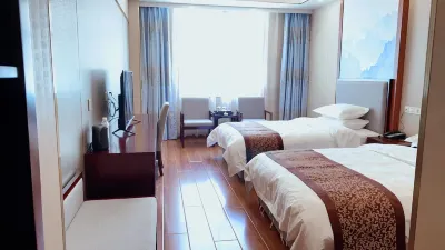
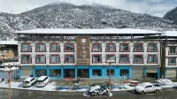
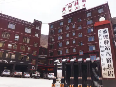
PPengguna Tetamu 2024.07.29
入住八宿紫宸泊閲酒店,設施齊全,免費停車,房間寬尚整潔,環境幽靜,雖然樓層不高但配有電梯,老少出入非常方便。酒店有特色美食,早餐樣式豐富,離然烏湖近,早晨漫步湖邊,可觀藍水與洪流交壁,雲山霧罩。
Bagus
400 ulasan
4.2/5
Harga bermula
€ 87
satu malam
Hotel berhampiran Baxoi
Rryantong 2023.09.26
房間整潔舒適寬敞,酒店有停車場,適合自駕遊旅客,酒店付近有很多餐廳選擇。離開當天遇上停電,很感激酒店員工幫忙從3樓幫忙提行李箱往地下大堂。
Cemerlang
93 ulasan
4.6/5
Harga bermula
€ 28
satu malam

Hotel berhampiran Baxoi
PPengguna Tetamu 2024.05.08
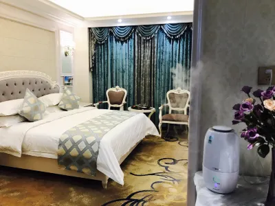
酒店房間很乾凈温馨,老闆非常熱心周到,暖氣很足,而且還配置氧氣,晚上睡覺很安靜,酒店環境很好,晚上可以在酒店四樓的茶吧看星空和雪山視野絕佳。歡迎水果很給力,有水果,特侖蘇和暖寶寶。房間窗户外面就是雪山景色,很贊。房間還有製氧和加濕器,停車場還能自助洗車,值得再來的酒店。
Cemerlang
154 ulasan
4.6/5
Harga bermula
€ 31
satu malam
Hotel berhampiran Baxoi
PPengguna Tanpa Nama 2024.12.01
房間乾淨,向陽,地暖,製氧機等各種設施配備齊全,房間向陽,窗户外面可直觀雪山,草地,然烏湖;老闆人很好,服務周到,晚安牛奶;還贈送來古冰川優惠卷20元;酒店距離來古冰川20min車程,交通便利!
Cemerlang
166 ulasan
4.8/5
Harga bermula
€ 47
satu malam

Hotel berhampiran Baxoi
PPengguna Tetamu 2024.06.25
性價比高,免費大停車場,前台美女介紹去門口的藏餐也好吃,真心不錯啊,還升級了豪華標間,讓我對八宿這座城多了一份喜歡啊
Cemerlang
66 ulasan
4.6/5
Harga bermula
€ 19
satu malam

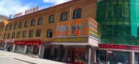
Hotel berhampiran Baxoi
2023.07.04
#衞生房間衞生挺乾淨的,能看出來床鋪被單都是新換的#服務老闆超級好,幫我們找了八宿到芒康的拼車,收費價格也便宜,非常感謝#位置交通離客運站步行不到10分鐘,出門右拐一條街都是飯店#房間設施有空調,雖然價格很便宜要空調遙控器的時候也沒嘰嘰歪歪的走的比較趕,沒拍照片
31 ulasan
3.9/5
Harga bermula
€ 7
satu malam


Hotel berhampiran Baxoi
PPengguna Tetamu 2024.06.22
房間新裝修,非常乾淨,整潔,老闆態度温柔體貼,停車方便,吃飯很邁,很滿意的一晚住宿。
Cemerlang
33 ulasan
4.6/5
Harga bermula
€ 11
satu malam
Hotel popular di Baxoi
Lihat semua
Pilih daripada senarai hotel terlaris bulan lalu
No.1

4.4/5
8 ulasanBasu Rega Glacier Homestay
Hotel di Baxoi
"Tuan rumah yang peramah"
Pilih tarikh untuk melihat hargaNo.2
4.6/5
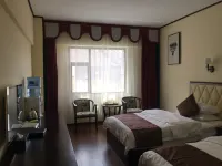
66 ulasanBlue Lake Station (Basu Head Office)
Hotel di Baxoi
"Tuan rumah yang peramah""Bersih dan kemas"
Pilih tarikh untuk melihat hargaNo.3
4.1/5
138 ulasanBasu Yutai Hotel
Hotel di Baxoi
"Tempat letak kereta strategik""Bilik selesa"
Pilih tarikh untuk melihat hargaNo.4
4.6/5
140 ulasanOxygen Fukuoka Hotel Basu Dorara
Hotel di Baxoi
"Bilik selesa""Bersih dan kemas"
Pilih tarikh untuk melihat hargaNo.5
4.1/5
37 ulasanBasu Yunshu Hotel
Hotel di Baxoi
"Bersih dan kemas""Tuan rumah yang peramah"
Pilih tarikh untuk melihat hargaNo.6
4.3/5
448 ulasan1980 Boutique Hotel
Hotel di Baxoi
"Bilik selesa""Penyambut tetamu yang peramah"
Pilih tarikh untuk melihat hargaNo.7
4.5/5
24 ulasanBasu Xingyuan Boutique Hotel
Hotel di Baxoi
"Tuan rumah yang peramah""Bersih dan kemas"
Pilih tarikh untuk melihat hargaNo.8
4.4/5
56 ulasanJourney to the station
Hotel di Baxoi
"Bilik selesa""Tuan rumah yang peramah"
Pilih tarikh untuk melihat hargaNo.9
4.3/5
55 ulasanBasuran Wuming Lake Mountain View Hotel
Hotel di Baxoi
"Bilik selesa""Nilai yang hebat"
Pilih tarikh untuk melihat hargaNo.10
4.0/5
2 ulasan來古冰川雅啦嗦民宿
Hotel di Baxoi
"Good Location"
Pilih tarikh untuk melihat hargaLihat ulasan pelancong lain tentang hotel di Baxoi
Lihat semua
Semak ulasan daripada pelancong lain untuk membantu anda mencari penginapan yang sempurna
4.7/5
Cemerlang
PPengguna Tetamu設施:民宿是新開的,床品毯子傢俱,衞浴都是新的。房間很乾凈,因為擔心高反,沒有洗澡,但是水龍頭的熱水很燙,洗臉刷牙足夠了。因為電路暫時還沒調整,所以容易跳閘,地暖不能開太高,老闆説已經請了人,這周就有人來處理了。
服務:民宿氛圍特別好,大家聚在客廳烤火,交換一下旅行路上的訊息(比如封路情況,景點值不值得去)就像是住在朋友家裡。老闆普通話一般,但是很熱情,有問題有需求都會盡量解決,絕對不會拖着糊弄。女主人卓瑪姐姐有點害羞,不善言辭,但是非常友善。
衞生:非常乾淨,用品都很新,是住過的三家藏式民宿裏最乾淨的了。
環境:周圍非常安靜,不用出院子,房子後面就可以用手機+三腳架延時攝影,或者相機拍日照金山,配上湖景絕美。還可以拍星空。
4.7/5
Cemerlang
房間挺大的,設施都挺新,看起來乾淨,有空調睡覺也不冷,停車很方便,樓下還有洗衣機可以洗衣服,還能進行烘乾,洗漱用品都挺好,不過洗手間有點反水的味道,晚上不知道附近哪裡的狗🐶一直叫有點影響休息,其他都很好,前台服務態度也不錯,性價比還是挺高的👍
4.6/5
Cemerlang
PPengguna Tetamu位置蠻好的,靠加油站!停車在自己院子裏,很方便安全!老闆很熱情,房間很乾凈,被褥舒適!
4.6/5
Cemerlang
PPengguna Tetamu房間新裝修,非常乾淨,整潔,老闆態度温柔體貼,停車方便,吃飯很邁,很滿意的一晚住宿。
4.0/5
Bagus
PPengguna Tetamu因為冬天來古村水都凍住了,所以用水比較困難,但老闆和老闆娘已經盡力了,早上就在房間裏拍日出,日照金山的全過程都拍下來了,我是坐班車到然烏鎮的老闆非常好,及時給我聯繫了車,25元就送到他家了,非常非常感謝老闆,我因為腹瀉,提前一天退了房,老闆二話不説就把房費退給我了。旅遊能遇上這麼好的藏族老闆是我的幸運!萬分感謝啊!
3.9/5
#衞生房間衞生挺乾淨的,能看出來床鋪被單都是新換的#服務老闆超級好,幫我們找了八宿到芒康的拼車,收費價格也便宜,非常感謝#位置交通離客運站步行不到10分鐘,出門右拐一條街都是飯店#房間設施有空調,雖然價格很便宜要空調遙控器的時候也沒嘰嘰歪歪的走的比較趕,沒拍照片
3.9/5
WWandouss當天比較晚到酒店,老闆説是不知道為什麼三人間被人定去我還能定,後來給了2個房間,家庭房和一個大床房,老闆服務還是可以的。房間內有加濕器和製氧機,就是不太會用,建議可以在房間裏放一個使用説明會更好。
3.9/5
JJianglingfute4sdian設施:乾淨整潔自然
衞生:乾淨整潔舒適
環境:安靜,條件好
服務:服務態度很好設施:乾淨整潔自然
衞生:乾淨整潔舒適
環境:安靜,條件好
服務:服務態度很好!好👌
3.9/5
PPengguna Tanpa Nama房間很不錯,酒店後面就可以停車,非常的方便,對了,老闆還提前把電熱毯打開,也是第一次遇到,感覺非常的暖心!
2.3/5
DDongchuhuangsiniangHotel ini sangat senang, di sebelah Lebuhraya Nasional 318. Makanan bosnya enak, dan isteri bosnya muda dan cantik, responsif dan sangat berkebolehan. Terlalu sukar. Saya tidak dapat berehat sebelum dan selepas berlari, yang membuat orang merasa tertekan.
Ulasan tetamu tentang tempat menarik di Baxoi
Terokai destinasi yang wajib anda lawati di Baxoi dan pilih hotel dekat untuk keselesaan terbaik
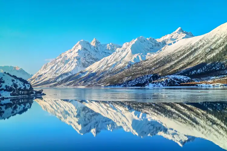
Ranwu Lake
周周星2532Very beautiful, but the most beautiful to see Shangran Wuhu, navigate to the Xiudeng Temple, that mountain pass overlooks the entire Shangran Wuhu Lake. Zhongran Wu and Xiran Wuhu are yellow in non-spring, and the view may not be so good. And Shangran Wuhu is blue blue all year round, very beautiful.
Laigu Glacier
MM44***61It is worth a visit to the 10,000-year-old blue ice cave. It is still there when the wind is not warm, so go after it if you have a dream. Only in January and February every year, after the lake is covered with thick ice, you can get close contact. Life is a wilderness, feel the charm of nature, enrich the life experience, understand the long, classy taste of human civilization, and get different energy.
Ranwuzhen
EenjoyzentRanwu Town is located in the southwest of Basu County in Qamdo District. Of course, it is named after Ranwu Lake. It has a natural scenery. Under the snowy snowy mountains, the yellow and green grasslands are scattered with black and white cattle and sheep. The streams are flowing and the twigs on the stream are crystal clear. Everything is so simple and natural harmony!
Laigu Village
风风的呢喃1963The beginning of the new year is a post-February Erlong look up. I said that today is exactly the legendary February Erlong look up. It should be considered the scene when I look up at the snow-capped mountains. [Witty] Picture one, when we withdrew from Dongga Glacier, I accidentally turned back, and was surprised to find that we just dropped the Dongga Glacier with beautiful clouds floating above, at least my first feeling was like a swimming dragon ~~~, hurry up and take a picture. From Dongga Glacier back to the inn about 2 pm, with lunch, Guizhou brothers and four people ready to drive to Nyingchi, I continued to pull the car, take the Yalong Glacier Ice Lake to get off, the afternoon is a good weather, this can not waste time. Walking and patting, returning from the lake to the inn, although the road is the dirt road and the cattle road, the scenery seen along the way is another. I have been in the ancient village for two days, and I am walking every day. I don’t charge tickets to the ancient glacier. I didn’t try the self-abuse itinerary that needed to be camped. I basically played the ordinary tourist itinerary in depth and I can leave tomorrow. [Wangchai] If I don’t leave anymore, my friends think I’m crazy. In the evening, the inn came to the second group of guests, an old master of bicycle driving photography, and the other car was three travel friends in Yunnan. The inn was immediately lively. Good night ~~~
Zig-Zag Mountain Road With 72 Turns
心心语_不问园From Zuogong to Ranwu 286 kilometers, will pass the altitude of Yela Mountain 4658 meters, and the altitude of Angula Mountain 4325 meters. There are two Nujiang 72 turns and Yela Mountain 99 turns. In the endless turn back and card bend, the snow-capped mountains are no longer beautiful!
Duola Fairy Mountain
CCD云上Bangda grassland spans five or six counties, and many places are no one smoked at all. It has the nickname "the grassland where the eagle can't fly". The average altitude here is more than 4,200 meters. In summer, the grassland is full of marshlands, and the meltwater and rainwater of the snow-capped mountains are flowing everywhere. The snow-capped mountains and rainwater slowly converged into countless streams, and finally flowed into Yuqu. This scene was like a ribbon flying on the endless grassland. At the end of the distant horizon, there was a gentle and fickle mountain. On the river bank, the wild thousands of miles, the green grass is like a grass, the water grass is beautiful, the cattle and sheep are flocked, and there are rare Tibetan originals infested from time to time, which is simply too beautiful. This place was once the famous "Tea Horse Ancient Road" must pass through, and now it has opened up roads connecting Tibet and Sichuan, Shanghai and Qingdao to neighboring provinces such as Sichuan, Sichuan and Sichuan. | Bangda Grassland |📍 Coordinates: 50 meters west of National Highway 318, Basu County, Changdu, Tibet Autonomous Region 📌 Tips: The temperature difference here is very large, you must bring a thick coat. You must wear light-colored clothes, white, light yellow, light orange, light orange, light blue will be more. This ultraviolet light is stronger, pay attention to sun protection, there is also dry, pay attention to moisturizing, sunglasses, hats. If you take pictures, you can interact with animals, and there are various grabs running on the grassland, how to shoot how natural, starry sky and starry river and sunrise and sunset.
Banda Grassland
非非凡轶生Bangda Grassland is located in Qamdo region of Tibet Autonomous Region. Bangda Grassland in the alpine valley of the Sanjiang River Basin is a high-cold grassland with a gentle terrain and beautiful water and grass. Bangda Grassland is more than 130 kilometers away from Basu County.
Renlongba Glacier
MM52***83Renlongba Glacier is located in the "Rilongba" of Rilong Town on the high mountain at the junction of Ranwu Town and Chayu County in Basu County, Changdu City, Tibet. The end of the ice tongue is 4,560 meters above sea level, several kilometers long, and the snowy mountains behind it are rare modern mountain glaciers of mid- and low latitudes on Earth. It was a fan-shaped glacier sandwiched by two snow peaks, the slope of the glacier was gentle, the ice tongue stretched out out of the valley, like a silver dragon, hovering between the mountains, shining brightly in the sun.
Soalan Lazim Tentang Hotel Baxoi
Apakah hotel yang popular di Baxoi?
Baxoi mempunyai banyak hotel yang popular. Sama ada anda melancong atas urusan perniagaan ataupun bercuti, Jimi Hotel(Ranwu Lake Branch), Zichen Boyue Hotel dan Basu Rega Glacier Homestay merupakan hotel pilihan.
Berapakah harga purata untuk hotel di Baxoi?
Bagi hotel di Baxoi, harga purata pada hari bekerja ialah € 42, harga purata pada hujung minggu (Jumaat–Sabtu) ialah€ 42.
Manakah hotel mewah di Baxoi yang disyorkan?
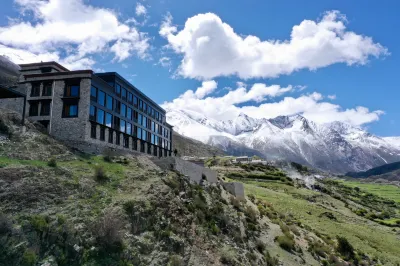
Baxoi mempunyai banyak hotel mewah dengan gaya berlainan. Songtsam Laigu Lodge (Ranwu) adalah sangat popular.
Manakah hotel di Baxoi yang menyediakan sarapan pagi berkualiti tinggi?
Songtsam Laigu Lodge (Ranwu),Jimi Hotel(Ranwu Lake Branch) dan Zichen Boyue Hotel menyediakan sarapan pagi berkualiti tinggi. Mulakan hari anda dengan sarapan pagi yang enak!
Manakah hotel di Baxoi yang disyorkan untuk pelancong yang membawa anak-anak?
Duola Shenshan Hot Spring Hotel, Basu Xingyuan Boutique Hotel dan Journey to the station amat sesuai untuk melancong bersama keluarga. Berseronoklah melancong bersama anak-anak dan ahli keluarga yang lain!
Manakah hotel di Baxoi yang menyediakan kemudahan kecergasan?
Jimi Hotel(Ranwu Lake Branch), Zichen Boyue Hotel dan Basu Rega Glacier Homestay menyediakan kemudahan kecergasan. Penuhi keperluan kecergasan anda walaupun anda sedang melancong!
Manakah hotel di Baxoi membenarkan bawa haiwan peliharaan?
Jimi Hotel(Ranwu Lake Branch), Zichen Boyue Hotel dan Taihong Theme Hotel membenarkan bawa haiwan peliharaan. Bawa haiwan peliharaan anda menginap bersama!
Manakah hotel di Baxoi yang mempunyai kolam renang?
Zichen Boyue Hotel, Taihong Theme Hotel dan Duola Shenshan Hot Spring Hotel ialah hotel yang mempunyai kolam renang. Menginaplah di mana-mana satu hotel ini untuk berseronok di kolam renang!
Manakah hotel di Baxoi yang menyediakan Wi-Fi percuma?
Sama ada anda melancong atas urusan perniagaan ataupun bercuti, sambungan Internet merupakan suatu kepentingan bagi perjalanan itu. Jimi Hotel(Ranwu Lake Branch), Zichen Boyue Hotel dan Basu Rega Glacier Homestay ialah hotel popular yang menyediakan Wi-Fi percuma.
Manakah hotel di Baxoi menawarkan perkhidmatan ulang-alik lapangan terbang?
Tidak kenal dengan Baxoi? Jimi Hotel(Ranwu Lake Branch), Zichen Boyue Hotel dan Basu Rega Glacier Homestay menyediakan khidmat angkut lapangan terbang.
Manakah hotel di Baxoi mempunyai spa yang berbaloi untuk dialami?
Berasa letih selepas perjalanan? Jimi Hotel(Ranwu Lake Branch), Zichen Boyue Hotel dan Basu Rega Glacier Homestay menyediakan khidmat spa bertaraf tinggi.
Apakah tawaran hotel yang tersedia di Baxoi?
Trip.com menyediakan pelbagai promosi dan diskaun untuk pengguna sepanjang tahun. Anda boleh semak halaman promosi untuk melihat promosi yang tersedia di Trip.com.
Maklumat Hotel Pelancong
| Harga Tertinggi | € 189 |
|---|---|
| Harga Terendah | € 8 |
| Bilangan Ulasan | 17,756 |
| Bilangan Hotel | 216 |
| Harga Purata (Hari Bekerja) | € 42 |
| Harga Purata (Hujung Minggu) | € 42 |